Arno Laurie
State Estimation & Navigation
Robotics MSc·EPFL·ERC 2025 & 2026 Winner
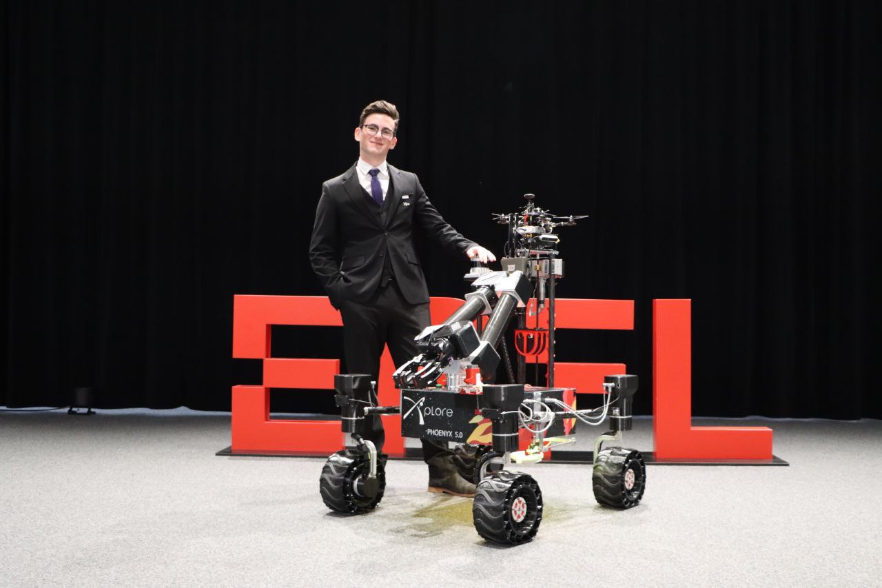
About Me
I am a Robotics MSc student at EPFL specializing in state estimation. I build real-time localization systems: factor-graph optimization, Kalman filtering, SLAM and multi-sensor fusion for GNSS-denied platforms.
As a Navigation Engineer at VLRX, I design a factor-graph localization solver for a Low Earth Orbit positioning, navigation and timing (PNT) system. It fuses satellite measurements with IMU, VIO, magnetometer and barometer data. Before that, I developed the AHRS firmware for a custom PCB at coprod SA.
At EPFL Xplore, I led the navigation subsystem of the rover that won the European Rover Challenge 2025. I then led the software of the rover that won ERC 2026, coordinating a team of 15 engineers. My experience ranges from embedded C++ firmware to full ROS 2 navigation stacks.
Projects
Featured — SLAM & State Estimation
★ ERC 2025 Winner
LiDAR-Inertial SLAM — Mars Rover Navigation Stack
EPFL Xplore | Team Leader Autonomous Navigation | Sep 2024 — Aug 2025
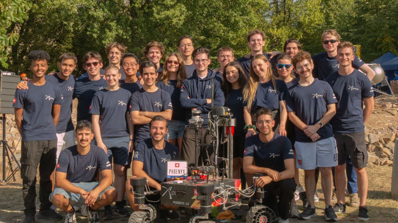
Led the autonomous navigation subsystem — localization, SLAM and path planning — of a 4-wheeled Mars rover competing in the European Rover Challenge 2025. GPS-denied outdoor terrain, no fallback.
SLAM & Localization:
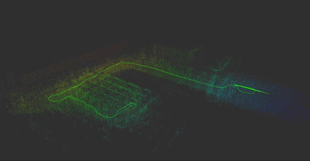
- LiDAR-inertial SLAM pipeline (Ouster 3D LiDAR + 9-axis IMU)
- Custom Extended Kalman Filter with a double-Ackermann kinematic model, fusing wheel odometry, IMU, and LiDAR-inertial odometry
- Global pose corrections via triangulation, trilateration and computer vision, solved with convex optimization (CVXPY/ECOS)
- Sub-15 cm accuracy in GPS-denied outdoor environments
- Production SLAM systems tuned on hardware: LIO-SAM, FAST-LIO2, GLIM
Planning & Control:
- Nav2 stack with Hybrid A* global planner
- Pure Pursuit path tracking with double-Ackermann kinematics
- Dynamic obstacle avoidance
Technologies:
C++ Python ROS2 OpenCV Docker Gazebo Arduino maxon EPOS
★ ERC 2026 Winner
EPFL Xplore — Software Lead of the ERC 2026 Rover
EPFL Xplore | Software Systems Engineer | Sep 2025 — August 2026
Led the software of the rover that won the European Rover Challenge 2026, coordinating a team of 15 engineers. Back-to-back win after ERC 2025.
System architecture (end-to-end owner):
- Autonomous navigation with ROS2 and Nav2
- Robotic arm control with MoveIt
- Wireless links with Mikrotik routers and software-defined radio
- Perception, planning and control integrated on NVIDIA Jetson, fusing IMU, LiDAR and RGB camera data
- Full software stack containerized with Docker for reproducible field deployment
Technologies:
C++ Python ROS2 Nav2 MoveIt OpenCV Docker maxon EPOS
★ SLAM
Real-Time 3D SLAM with Gaussian Mixture Models
Spring 2026
A real-time 3D SLAM stack in C++ built on GTSAM factor-graph optimization, fusing LiDAR point clouds and IMU data. The map is a Gaussian Mixture Model, a compact representation of the environment.
Architecture:
- Front-end: point-cloud registration for incremental odometry; IMU preintegration for inter-frame constraints
- Back-end: GTSAM factor-graph optimization in real time
- Place recognition: loop closure detection and pose-graph correction
- Map: Gaussian Mixture Model map instead of a dense point cloud
Technologies:
C++ GTSAM PCL Eigen ROS2 LiDAR IMU
Other Projects
Robust and Non-Linear MPC for Rocket Landing
Academic Project | Fall 2025
Designed and tuned robust and non-linear model predictive controllers for a 6-DOF rocket landing.
Technologies:
Python CasADi MPC Optimization
STM32 RTOS Autonomous Mobile Robot
Academic Project | Spring 2025
Real-time autonomous navigation on the e-puck2 platform using ChibiOS RTOS. Extended Kalman Filter for localization, real-time obstacle detection and mapping, efficient RTOS task scheduling, sensor fusion with IMU and proximity sensors.
Technologies:
STM32 ChibiOS C EKF Embedded Systems
Thymio Autonomous Mobile Robot
Academic Project | Fall 2025
Autonomous navigation with EKF localization and ArUco tag triangulation & trilateration using convex optimization (CVXPY/ECOS). Global path planning and real-time obstacle detection.
Technologies:
Python EKF OpenCV CVXPY
Solar Tracking Solar Oven
Personal Project | Fall 2025 — Ongoing
2-DoF sun-tracking system with custom DC-DC Buck converter PCB, ESP32 on FreeRTOS, lux sensor array, PID motor control, and mechanical design in Fusion 360.
Technologies:
ESP32 FreeRTOS KiCad Fusion 360 PID
Angle-of-Arrival RF Localization — LibreSDR
Personal Project | Fall 2025
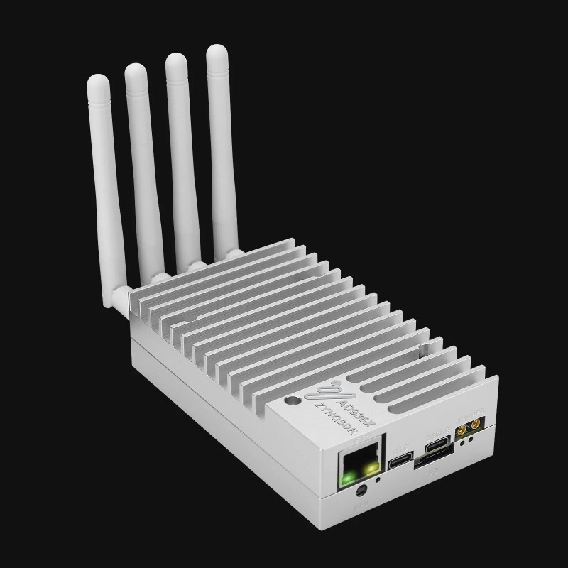
Angle-of-arrival radio direction finding with software-defined radio hardware. MUSIC and Root-MUSIC implementations on the LibreSDR platform.
Technologies:
Python SDR Signal Processing
Technical Skills
Toolbox
State estimation: EKF UKF Factor graphs (GTSAM) SLAM Multi-sensor fusion GNSS / PNT
Robotics: ROS2 Nav2 MoveIt Gazebo PCL MPC (CasADi)
Software: C++ Python Linux Docker Git OpenCV MATLAB / Simulink
Embedded & RF: STM32 ChibiOS FreeRTOS Software-defined radio KiCad LTspice
CAD: Fusion 360
Experience
VLRX Sàrl — Navigation Engineer, LEO Positioning, Navigation and Timing
Designing a factor-graph localization solver for a Low Earth Orbit PNT ranging system. The solver fuses satellite measurements with IMU, VIO, magnetometer and barometer data, and estimates position, velocity and receiver clock bias in ECEF/WGS84. Wrote the engineering specification for the solver.
C++ Factor graphs Sensor fusion
coprod SA — Firmware Engineer, Attitude and Heading Reference System
Developed the AHRS firmware for a custom PCB. Implemented redundant IMU fusion, sensor calibration, and magnetic disturbance rejection for reliable heading estimation.
C++ Embedded systems
EPFL Xplore — Software Systems Engineer
Led the software of the rover that won the European Rover Challenge 2026, coordinating a team of 15 engineers. Own the end-to-end architecture: autonomous navigation (ROS2/Nav2), arm control (MoveIt), and wireless links (Mikrotik routers and SDR). Integrated perception, planning and control on NVIDIA Jetson, fusing IMU, LiDAR and RGB camera data. Containerized the full software stack with Docker for reproducible field deployment. Won 1st place at the European Rover Challenge 2026.
C++ Python ROS2 Nav2 MoveIt OpenCV Docker maxon EPOS
EPFL Xplore — Team Leader, Autonomous Navigation
Led the navigation subsystem of the ERC 2025 rover: localization, SLAM and path planning. Developed a custom Extended Kalman Filter with a double-Ackermann kinematic model. Integrated LiDAR-inertial SLAM for mapping and localization on Mars-analogue terrain. Localized the rover with triangulation, trilateration and computer vision. Coordinated hardware–software integration with the mechanical and electrical teams. Won 1st place at the European Rover Challenge 2025.
C++ Python ROS2 Nav2 OpenCV Gazebo Docker Arduino
EPFL Xplore — Software Engineer
Designed ROS2-based manual and autonomous navigation for outdoor rover operation. Implemented 2D LiDAR SLAM. Built a low-level PID motor controller on Arduino with custom wheel odometry.
C++ Python ROS2 Arduino
ETML — Machining Intern
Manual metal machining: turning, milling, drilling, tapping, and brazing.
Education
EPFL — Master of Science in Robotics
2025 — Ongoing
Relevant Coursework:
- Sensor Fusion and State Estimation
- Autonomous Navigation
- Computer Vision
- Convex Optimization
- Model Predictive Control
- Multivariable and Non-Linear Control
- Manipulation
- Machine Learning
EPFL — Bachelor of Science in Microengineering
GPA: 5.38 / 6 | 2022 — 2025
Relevant Coursework:
- Embedded Systems
- Control Systems
- Signals and Systems
- Digital System Design
- Electronics I & II
- PCB Design
- Probability and Statistics
École Européenne Luxembourg II
European Baccalaureate (Computer Science, Mathematics, Physics, Chemistry) | 95.02 / 100 | 2022
Bertrange, Luxembourg
- Secretary of the BAC Committee · Yearbook Committee
Awards & Certificates
European Rover Challenge 2026 — 1st Place
Led the software of the EPFL Xplore rover and coordinated a team of 15 engineers. Back-to-back win after ERC 2025.
European Rover Challenge 2025 — 1st Place
Led the autonomous navigation subsystem (SLAM, localization, path planning) that earned EPFL Xplore first place in the international Mars rover competition.
Luxembourg Informatics Olympiad — Semi-Finalist
Applied optimization and path-finding algorithms in competitive programming.
HB9 Amateur Radio Licence
Swiss amateur radio licence.
Languages
Native
Fluent — TOEFL iBT 112/120
Basic
Basic
Interests
Detailed Project Showcases
ERC 2025 — LiDAR-Inertial SLAM Navigation Stack
Problem
Design and deploy the autonomous navigation system for a Mars rover operating in GPS-denied, rough outdoor terrain — with no fallback localization source.
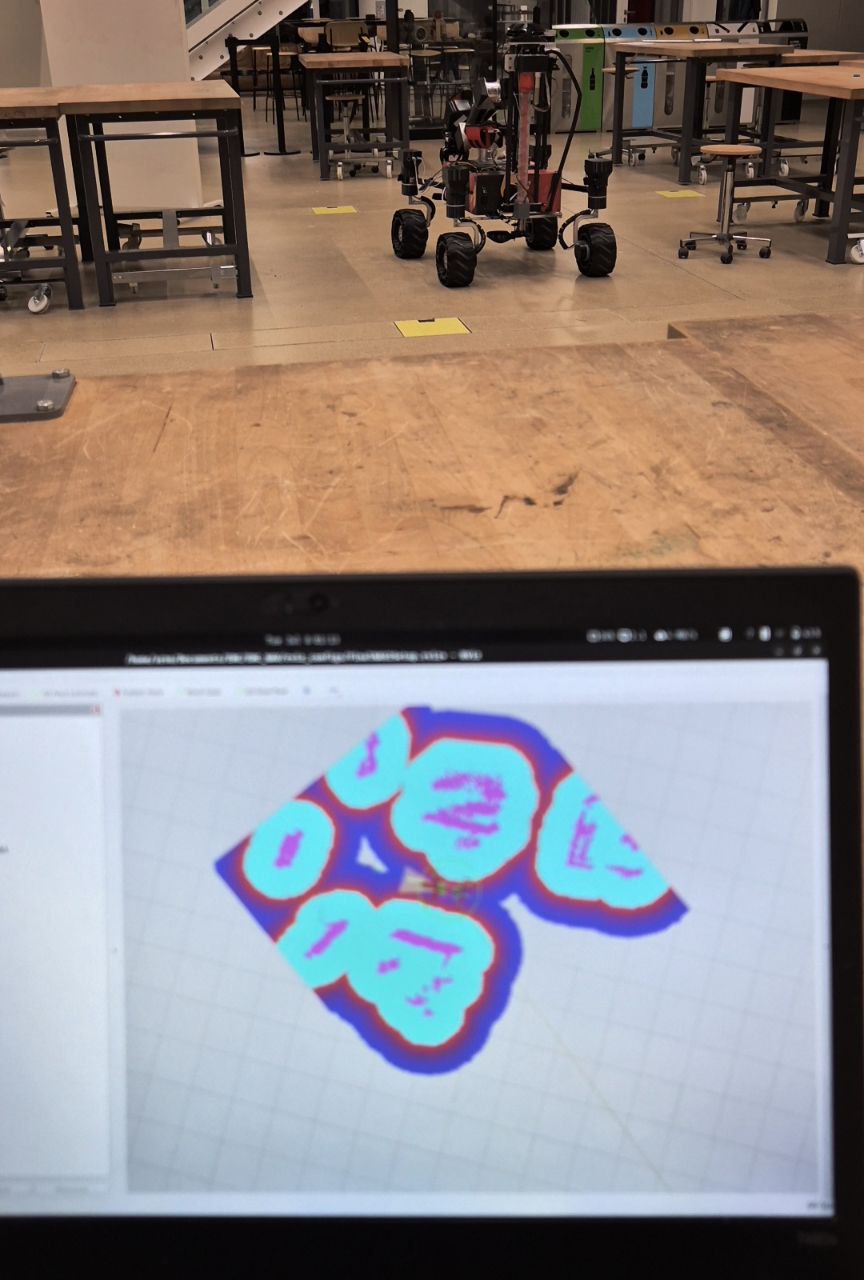
Localization & State Estimation
Sensor suite: Ouster 3D LiDAR + 9-axis IMU (accelerometer, gyroscope, magnetometer) + wheel encoders
- LiDAR-inertial odometry as the primary odometry source — high-frequency, drift-bounded
- Custom EKF fusing wheel odometry, IMU, and LiDAR-inertial poses; adaptive noise covariance tuning for outdoor terrain
- Double-Ackermann kinematics model for accurate motion prediction during tight turns
- Triangulation + trilateration for absolute pose correction using visual landmarks — solved as a Second-Order Cone Program (SOCP) with CVXPY + ECOS
Production SLAM systems tuned on hardware: LIO-SAM, FAST-LIO2, GLIM — used as references and for benchmarking the custom EKF stack.
Perception & Planning
- 3D Ouster LiDAR for obstacle detection and costmap generation
- Camera-based landmark detection (OpenCV)
- Nav2 Hybrid A* global planner + Pure Pursuit path tracking
- Dynamic obstacle avoidance with local planner
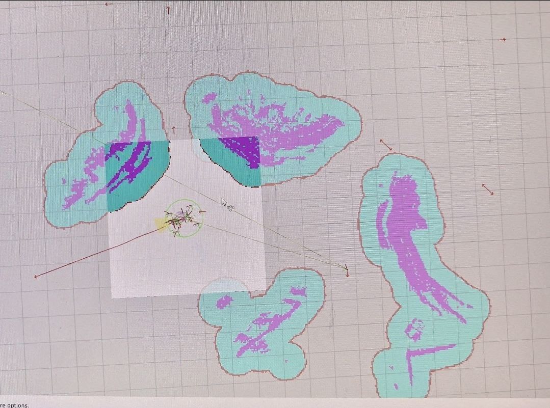
Results
| Metric | Result |
|---|---|
| Competition | European Rover Challenge 2025 — 1st Place |
| Localization accuracy | Sub 15 cm in GPS-denied outdoor terrain |
| Deployment | Full stack on NVIDIA Jetson in Docker |
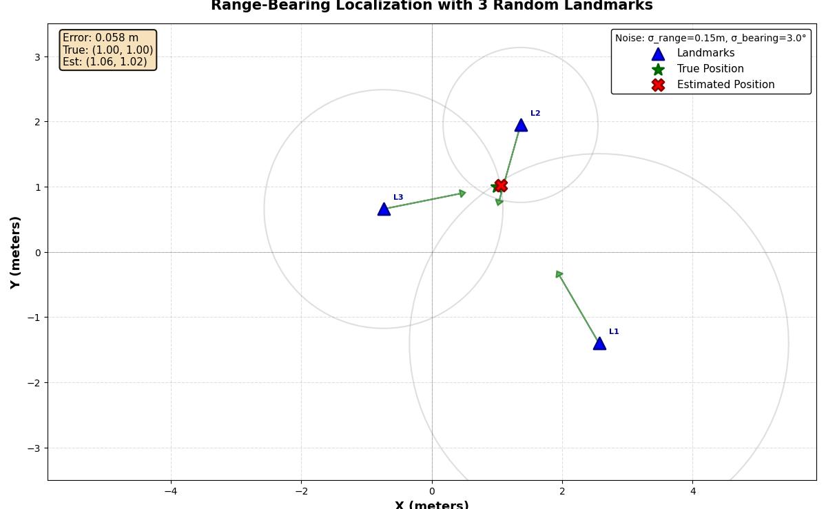
Landmark-based global pose correction: solved as a Second-Order Cone Program (SOCP) using CVXPY and the ECOS solver.
Contact
Open to research collaborations and opportunities in state estimation, navigation, and autonomous systems.
📧 Email: arno.laurie.pro@gmail.com
🔗 LinkedIn: linkedin.com/in/arno-laurie
💻 GitHub: github.com/Netfluxx
📍 Location: Lausanne, Switzerland
Last updated: October 2026